Night Sky
The Lower Similkameen is known for its exceptionally dark nights and clear skies; the only downside is that our steep valley limits the view of the horizon. What’s in the sky tonight?
Virtual Sky
You can change the settings for this projection by hovering your mouse over the star map and pressing the “?” button.
Satellites
You might also be interested in a list of bright satellites going overhead today (just be sure to update the the page to your present location).
Space Weather
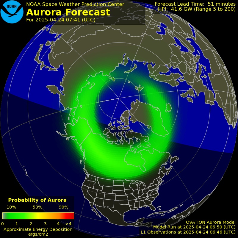
Are we likely to see an aurora tonight? Here is the current forecast for Aurora Borealis.

You can also access more details than you can imagine about the “weather” in space, right now: https://www.swpc.noaa.gov/communities/space-weather-enthusiasts-dashboard
Earthquakes
This section automatically updates regularly with any confirmed earthquakes in the region. For more detailed information, click on the link below the table.
[xyz-ips snippet=”Earthquakes”]Similkameen River
The Similkameen River is the backbone of our valley and provides numerous recreation opportunities, including swimming, tubing, fishing and more–but river conditions are always changing. These readings are from a gauge at the Canada/USA border, just south of us.
Water Temperature (last 7 days)
River Level (gauge height) (last 7 days)
Discharge (flow) Rate (last 7 days)
More Locations
Real-time information is also available for the Similkameen River near Hedley and on the nearest upstream tributary, the Ashnola River.
What do the roads look like around us? Latest webcam footage from DriveBC.
Keremeos › Hwy 3 at Bypass Rd, looking westKeremeos › Hwy 3 at Bypass Rd, looking eastTwin Lakes › East:Hwy 3A, near Yellow Lake, looking eastOsoyoos › Hwy 3, near Spotted Lake, looking west
Burning
Kamloops Fire Centre Information (current campfire/burn bans, wildfire status and more)
Current Venting Forecast (Open burning anything larger than a campfire is only allowed if the weather is suitable to clear the smoke. The Venting Index measures the amount of low level winds and turbulence.)
Wildfires
BC Wildfire Map (Interactive Map)
Flights Overhead (Interactive Map)
What flights are currently passing overhead? Click on any aircraft on the map to learn its origin and destination, and much more.
BC Snow Stations (Interactive Map)
Automated Weather Station Data for current snow levels – Useful to estimate spring flooding risk.
